Претрага
32 items
-
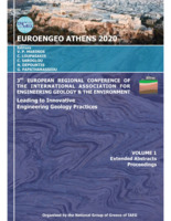
Results of comprehensive monitoring activities on Umka landslide, Belgrade, Serbia
Biljana Abolmasov, Uroš Đurić (2021)Biljana Abolmasov, Uroš Đurić . "Results of comprehensive monitoring activities on Umka landslide, Belgrade, Serbia" in 3rd European Regional Conference of IAEG/ Athens/ Greece/ 6-10 October 2021, IAEG National Group Greece (2021) М34
-
Primena termografije u rudarstvu
Stevan Đenadić, Vesna Damnjanović, Predrag Jovančić, Dragan Ignjatović, Dragutin Jovković, Filip Miletić (2019)Danas, gotovo da nema oblasti u nauci i tehnici u kojoj se Infracrvena termografija ne primenjuje kao metoda za lociranje i praćenje zagrejanih objekata ili tela, beskontaktnu procenu temperature površina, i nedestruktivno ispitivanje materijala. U radu su prikazane mogućnosti i perspektive primene ove metode u oblasti rudarstva.Stevan Đenadić, Vesna Damnjanović, Predrag Jovančić, Dragan Ignjatović, Dragutin Jovković, Filip Miletić. "Primena termografije u rudarstvu" in IX Međunarodna konferencija UGALJ 2019, Zlatibor, Srbija, 23-26. oktobar 2019., Jugoslovenski komitet za površinsku eksploataciju (2019) М33
-
Groundwater as an important resources in emergency situations of the Republic of Serbia
Boris Vakanjac, Radoje Banković, Vesna Ristić-Vakanjac, Saša Milanović, Ljiljana Vasić, Saša Bakrač, Nikola Kozić (2024)Groundwater is a renewable resource wholly or partially protected from external influences (pollutants) by nature. Currently, about 75% of the population of the Republic of Serbia meets its water needs by using underground water. Hence, this water represents an essential strategic resource of our country; according to data from the Water Management Foundation of the Republic of Serbia (VOS, 2001), water from existing sources is used in quantities of about 23 m3/s. As 67.13 m3/s is the estimated potential ...Boris Vakanjac, Radoje Banković, Vesna Ristić-Vakanjac, Saša Milanović, Ljiljana Vasić, Saša Bakrač, Nikola Kozić. "Groundwater as an important resources in emergency situations of the Republic of Serbia" in 11th International Scientific Conference on Defensive Technologies - OTEX 2024, Tara, October 2024, Military Technical Institute, Belgrade (2024). https://doi.org/10.5937/OTEH24122V М33
-
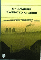
Moниторинг у животној средини - одабрана поглавља
Динко Кнежевић, Драгана Нишић, Александар Цвјетић, Драгана Ранђеловић, Зоран Секулић. Moниторинг у животној средини - одабрана поглавља, Београд : Универзитет у Београду, Рударско-геолошки факултет, 2015 Без категорије
-
Monitoring the Impact of Artificial Structure on Hydrogeological Environment: A Case Study of Hydraulic Tunnel at Pirot Hydropower Plant
Marina Čokorilo Ilić, Miroslav P. Popović, Dragoljub Bajić, Vesna Matović, Filip Abramović, Filip Alimpić (2024)hidroenergetski tunel, podzemne vode, hidrogeološki monitoring, pijezometri, fizičkohemijsko osmatranje, hidrometrija, unakrsna korelacijaMarina Čokorilo Ilić, Miroslav P. Popović, Dragoljub Bajić, Vesna Matović, Filip Abramović, Filip Alimpić. "Monitoring the Impact of Artificial Structure on Hydrogeological Environment: A Case Study of Hydraulic Tunnel at Pirot Hydropower Plant" in Sensors, MDPI AG (2024). https://doi.org/10.3390/s24206578 М21
-
Стање квалитета амбијенталног ваздуха на подручју града Панчева
Александар Маринковић (2024)Квалитет ваздуха је кључни фактор за здравље људи и очување животне средине. У овом завршном раду анализирано је стање амбијенталног ваздуха на територији града Панчева како би се сагледали извори загађења, ПЛН мониторинга и изазови у погледу квалитета ваздуха са којима се суочавају сви становници. Кроз примену савремених метода праћења, идентификовани су главни извори загађења и анализирана је дистрибуција загађујућих материја у урбаном окружењу.Праћењем концентрације загађивача као што су честице PM10, PM2.5, сумпор-диоксид (SO2), азот-диоксид (NO2) и други, ...Александар Маринковић. Стање квалитета амбијенталног ваздуха на подручју града Панчева, 2024
-
Стање квалитета амбијенталног ваздуха на подручју града Београда
Марко Колачарић (2024)У овом раду анализирано је стање квалитета амбијенталног ваздуха на територији града Београда. Анализа се заснива на праћењу података о загађујућим материјама прикупљеним у 2022. години са шест мерних места на територији града. Загађивачи који су обухваћени овом радом су сумпор-диоксид (SO2), азот-диоксид (NO2), честични загађивачи (PM2.5 и PM10), тропосферски озон (О3) и угљен-моноксид (СО). На основу добијених резултата предложене су мере за побољшање тренутног система. Констатовано је прекорачење законских граница на свим мерним местима, за једну или више ...Марко Колачарић . Стање квалитета амбијенталног ваздуха на подручју града Београда, 2024
-
Transboundary groundwater resources of Serbia - present status and future needs for sustainable management
Republic of Serbia is located at the crossroads of Southeast and Central Europe and belongs to the Central Balkans. With its 88,360 km2, Serbia is one of the larger countries of the Balkan Peninsula. It borders 8 countries and has at least one transboundary aquifer (TBA) with each of them. According to evaluation conducted for UNECE in 2008, Serbia has a total of 17 TBAs, out of which 15 are shared with one neighboring country, while two aquifers are shared with two or three ...Veljko Marinović, Branislav Petrović, Zoran Stevanović. "Transboundary groundwater resources of Serbia - present status and future needs for sustainable management" in Second International UNESCO Conference on Transboundary Aquifers, “ISARM2021: Challenges and the way forward”, Paris 2021, United Nations Educational, Scientific and Cultural Organization, 7, place de Fontenoy, 75352 Paris 07 SP, France (2021) М34
-
Groundwater resources for drinking water supply in Serbia´s Southeast Pannonian basin
Dušan Polomčić, Bojan Hajdin, Marina Ćuk, Petar Papić, Zoran Stevanović. "Groundwater resources for drinking water supply in Serbia´s Southeast Pannonian basin" in Carpathian Journal of Earth and Environmental Sciences (2014) М23
-
Results of Recent Monitoring Activities on Landslide Umka, Belgrade, Serbia—IPL 181
Biljana Abolmasov, Uroš Đurić, Jovan Popović, Marko Pejić, Mileva Samardžić Petrović, Nenad Brodić (2021)Biljana Abolmasov, Uroš Đurić, Jovan Popović, Marko Pejić, Mileva Samardžić Petrović, Nenad Brodić. "Results of Recent Monitoring Activities on Landslide Umka, Belgrade, Serbia—IPL 181" in Understanding and Reducing Landslide Disaster Risk. WLF 2020. ICL Contribution to Landslide Disaster Risk Reduction, Springer, Cham (2021). https://doi.org/10.1007/978-3-030-60196-6_14 М14
-
Režim pogranične reke Jerme
Vesna Ristić Vakanjac, Marina Čokorilo Ilić, Dušan Polomčić, Dragoljub Bajić, Boris Vakanjac, Peđa Kostić (2019)Reka Jerma izvire na Vlasinskoj visoravni u zoni Vlasinskog jezera, teče prema severozapadu padinama planine Gramade kroz selo Klisuru. Kod sela Strazimirovci prelazi u susednu državu Bugarsku, prolazi kroz Trnovsko ždrelo i zatim se ponovo vraća u Srbiju nedaleko od sela Petačinci. Uliva se kod sela Gradište u Nišavu. Ukupna dužina ove reke je 72.1 km od toga je 45.1 km formirala na teritoriji Srbije a preostali deo pripada Bugarskoj. Posmatrajući površine sliva nešto manje od 50 % pripada ...Vesna Ristić Vakanjac, Marina Čokorilo Ilić, Dušan Polomčić, Dragoljub Bajić, Boris Vakanjac, Peđa Kostić. "Režim pogranične reke Jerme" in Zbornik radova II Međunarodne naučne konferencije, Regionalni razvoj i prekogranična saradnja, Pirot, 2018., UO Privredna komora Pirot (2019) М33
-
Simulation of Hydrogeological Environmental Discharge in Case of Interruption Constant Observations
Marina Čokorilo Ilić, Dragoljub Bajić, Miroslav Popović. "Simulation of Hydrogeological Environmental Discharge in Case of Interruption Constant Observations" in International Scientific Conference - Sinteza 2024, Belgrade, 16. maj 2024, Singidunum University (2024). https://doi.org/10.15308/Sinteza-2024-288-294 М31
-
Permanent GNSS monitoring of landslide Umka
Mileva Samardžić Petrović, Jovan Popović, Uroš Đurić, Biljana Abolmasov, Marko Pejić, Miloš Marjanović (2020)Клизиште Умка је једно од највећих насељених активних клизишта у Србији. Активност клизишта Умка се прати већ више од 85 година, различитим геотехничким и геодетским техникама. Од 2010. године, активност kлизишта се континуирано прати у реалном времену аутоматизованим перманентним системом за праћење базираним на Глобалним навигационим сателитским системима (ГНСС). Поред тога, од 2018. године активност клизишта се додатно прати кинематичким ГНСС одређивањем положаја скупа карактеристичних тачака као и применом UAV фотограметрије. Главни циљ овог рада је приказ резултата опажања три ...Mileva Samardžić Petrović, Jovan Popović, Uroš Đurić, Biljana Abolmasov, Marko Pejić, Miloš Marjanović. "Permanent GNSS monitoring of landslide Umka" in International Conference on Contemporary Theory and Practice in Construction XIV Stepgrad, University of Banja Luka, Faculty of Architecture, Civil Engineering and Geodesy (2020). https://doi.org/10.7251/STP2014091S М33
-
Preliminary analysis of Krupaja Spring discharge (Еastern Serbia)
Jovana Nikolić, Vesna Ristić Vakanjac, Saša Milanović, Zoran Stevanović, Ljiljana Vasić. "Preliminary analysis of Krupaja Spring discharge (Еastern Serbia)" in National Conference with international participation “Geosciences 2020”, Review of the Bulgarian Geological Society, vol. 81, part 3, Sofia : Bulgarian geological society (2020) М34
-
Towards Better Valorisation of Industrial Minerals andRocks in Serbia—Case Study of Industrial Clays
Vladimir Simić, Dragana Životić, Zoran Miladinović. "Towards Better Valorisation of Industrial Minerals andRocks in Serbia—Case Study of Industrial Clays" in Resources, MDPI AG (2021). https://doi.org/10.3390/resources10060063 М51
-
Impact of Covid-19 on the Mining Sector and Raw Materials Security in Selected European Countries
Andrzej Gałaś, Alicja Kot-Niewiadomska, Hubert Czerw, Vladimir Simić, Michael Tost, Linda Wårell, Slávka Gałaś (2021)Andrzej Gałaś, Alicja Kot-Niewiadomska, Hubert Czerw, Vladimir Simić, Michael Tost, Linda Wårell, Slávka Gałaś. "Impact of Covid-19 on the Mining Sector and Raw Materials Security in Selected European Countries" in Resources, MDPI AG (2021). https://doi.org/10.3390/resources10050039 М51
-
The ‘Umka’ landslide
We present an in-depth landslide map of the ‘Umka’ landslide near Belgrade, Serbia, at a scale of 1:5000. The map delineates elements at risk, primarily buildings and road infrastructure impacted by the landslide displacements of several cm per year, introduced during frequent reactivation stages. The Main map results from a survey of over 350 buildings and more than 7 km of state and local roads. The acquisition techniques included engineering geological field mapping, building survey, and visual interpretation of ...rizik od klizišta, elementi rizika, kartiranje pomoću drona, ispitivanje objekata, geotehnički monitoringUroš Đurić, Dragana Đurić, Miloš Marjanović, Biljana Abolmasov, Ivana Vasiljević. "The ‘Umka’ landslide" in Journal of Maps, Informa UK Limited (2024). https://doi.org/10.1080/17445647.2024.2418580 М22
-
Transboundary groundwater resource management: needs for monitoring the Cijevna River Basin (Montenegro–Albania)
The transboundary Cijevna River Basin shared between Albania and Montenegro has a surface area of 650 km2. It is extremely important for water management, especially in the country of Montenegro which is downstream. Due to the high permeability of both the karst and intergranular aquifers that exist in the basin, the River Cijevna sinks along the length of its riverbed and in summer months it usually dries up completely at the confluence section. Hydrometry surveys undertaken during a drought ...Upravljanje međugraničnim vodama, ranjivost podzemnih voda, monitoring mreža, karstne izdani, Albanija, Crna GoraMomčilo Blagojević, Zoran Stevanović, Milan Radulović, Veljko Marinović, Branislav Petrović. "Transboundary groundwater resource management: needs for monitoring the Cijevna River Basin (Montenegro–Albania)" in Environmental Earth Sciences, Springer Science and Business Media LLC (2020). https://doi.org/10.1007/s12665-020-8809-8 М22
-
Spatial distribution of major and trace elements in artificial lakes in Serbia: health risk indices and suitability of water for drinking and irrigation purposes
Goran Marković, Aleksandar Ž. Kostić, Nebojša Đ. Pantelić, Radojka Maletić, Jana Štrbački, Jovan Cakić, Lazar Kaluđerović, Biljana P. Dojčinović, Angelo Maria Giuffrè, Jelena B. Popović-Djordjević (2023)Lakes and reservoirs are the main water resources for household, irrigation, and industrial use. Hence, it is necessary to control water pollution and have reliable information on water quality, which refers to its suitability for a particular purpose. The main objective of this study was to evaluate the suitability of water for drinking and irrigation purposes from ten artificial lakes on the territory of the Republic of Serbia. The physicochemical parameters were determined using standard analytical methods, whereas the ...Goran Marković, Aleksandar Ž. Kostić, Nebojša Đ. Pantelić, Radojka Maletić, Jana Štrbački, Jovan Cakić, Lazar Kaluđerović, Biljana P. Dojčinović, Angelo Maria Giuffrè, Jelena B. Popović-Djordjević. "Spatial distribution of major and trace elements in artificial lakes in Serbia: health risk indices and suitability of water for drinking and irrigation purposes" in Environmental Monitoring and Assessment, Springer Science and Business Media LLC (2023). https://doi.org/10.1007/s10661-023-11740-6 М22
-
Assessment of spa mineral water quality from Vrnjačka Banja, Serbia: geochemical, bacteriological, and health risk aspects
Nebojša Đ. Pantelić, Simona Jaćimović, Jana Štrbački, Danijela B. Milovanović, Biljana P. Dojčinović, Aleksandar Ž. Kostić (2019)The goal of this study is to evaluate the quality of seven natural mineral water sources in the Vrnjačka Banja area used in the treatment of various diseases. The 24 macro- and microelements were determined by inductively coupled plasma optical emission spectrometry (ICP-OES). The results show that element content was within allowed limits of concentration, except for B, As, and Se. The evaluated content of these elements can be associated with geological and anthropogenic factors. The sample S6 contains ...Nebojša Đ. Pantelić, Simona Jaćimović, Jana Štrbački, Danijela B. Milovanović, Biljana P. Dojčinović, Aleksandar Ž. Kostić. "Assessment of spa mineral water quality from Vrnjačka Banja, Serbia: geochemical, bacteriological, and health risk aspects" in Environmental Monitoring and Assessment, Springer Science and Business Media LLC (2019). https://doi.org/10.1007/s10661-019-7848-7 М22
