Претрага
251 items
-
Оцена перспективности изворишта "Вић баре" за водоснабдевање Обреновца
... main waterworks system have initiated hydrogeological research and creation of hydrodynamical model of the exisiting source ,,Vié bare“ located in Sava River alluvium. The source consists of 30 vertical drilled wells and the two collector wells (with horizontal drains), which tapping in average 260 I/s ...
... vodostaja Save tokom jesenjih meseci (sept-dec.) u periodu 2001-2011. godine Figure 2. Comparative diagram of mean values of groundwater extraction and Sava river water levels during the autumn months (Sept.-Dec.) in the period 2001-2011 starenja bunara usled procesa kolmatacije koji su intenzivirani poviSenim ...
... Save i eksploatisanih koli¢éina voda na izvoristu u periodu jul, 2007-jul, 2008 Figure 4. Comparative diagram of fluctuations of groundwater levels, Sava river water levels and the exploited amount of water at the groundwater source during the period July 2007-July 2008 109 ...Бојан Хајдин, Душан Поломчић, Зоран Стевановић, Драгољуб Бајић, Катарина Хајдин. "Оцена перспективности изворишта "Вић баре" за водоснабдевање Обреновца" in XIV Српски симпозијум о хидрогеологији са међународним учешћем, Рударско-геолошки факултет, Београд (2012)
-
Single and multi-phase inclusions in garnets from the Lešnica alluvion in the Internal Dinarides, Serbia
Maja Milošević, Bojan Kostić (2021)... Dinarides, Serbia Maja Milošević and Bojan Kostić University of Belgrade, Faculty of Mining and Geology, Belgrade, Serbia Inclusions in garnets from the river Lešnica alluvion (Cer mountain area, Serbia), were investigatedin an effort to study their distribution within the garnet host and to estimate the mechanism ...
... samegarnet host with a random distribution are suggesting different genetic relations. [1] Milošević M., Kostić B., Vulić P., Jelić I. 2019. Garnets from river Lešnica alluvion, mountain Cer. IIKongres Geologa Bosne i Hercegovine sa medjunarodnim učešćem, Pp. 306-311 Powered by TCPDF (www.tcpdf.org) http://www ...Maja Milošević, Bojan Kostić. "Single and multi-phase inclusions in garnets from the Lešnica alluvion in the Internal Dinarides, Serbia" in EGU Assembly 2021, Copernicus GmbH (2021). https://doi.org/10.5194/egusphere-egu21-2423
-
Results of Recent Monitoring Activities on Landslide Umka, Belgrade, Serbia—IPL 181
Biljana Abolmasov, Uroš Đurić, Jovan Popović, Marko Pejić, Mileva Samardžić Petrović, Nenad Brodić (2021)... which was charac- terized by intensive fluctuation of the Sava River level (drawdown effect), which started dropping from high level for several meters in a short period. Fluctuation of the river level in 2014–2015 was followed by highest river discharge during floods in May 2014, particularly enhanced ...
... propose adequate remedial measures. Project results would also help in better understanding of other landslides found on the right bank of the Sava river. More details about the project mis- sion, objectives and goals can be found at Abolmasov et al. (2014, 2017). Comprehensive analysis and results ...
... monitoring activities conducted from 2014 to 2019 as a part of IPL 181 Project report. Study Area The study area is located on the right bank of the Sava river, 25 km South-west of Belgrade, the capital of Serbia. Extensive geotechnical investigations and monitoring activities were conducted during several ...Biljana Abolmasov, Uroš Đurić, Jovan Popović, Marko Pejić, Mileva Samardžić Petrović, Nenad Brodić. "Results of Recent Monitoring Activities on Landslide Umka, Belgrade, Serbia—IPL 181" in Understanding and Reducing Landslide Disaster Risk. WLF 2020. ICL Contribution to Landslide Disaster Risk Reduction, Springer, Cham (2021). https://doi.org/10.1007/978-3-030-60196-6_14
-
Uticaj klimatskih promena na vodne resurse: primer sliv reke Mlave
Vesna Ristić Vakanjac, Saša Milanović, Ljiljana Vasić, Boris Vakanjac, Saša Bakrač, Radoje Banković, Veljko Marinović (2023)Na teritoriji Jugositočne Evrope, pa samim tim i u delu gde živimo (Republika Srbija i Republika Bosna i Hercegovina) za očekivati je da dođe do značajnijeg porasta temperature vazduha u značajnijoj meri, što će imati značajnijeg uticaja na padavine, njihovu unutargodišnju raspodelu, kao i pojavu sve više prisutnih ekstremnih vrednosti (izuzetno sušnih i kišnih godina). Sve ovo će uticati i na sam režim površinskih i podzemnih voda, resursa bez kojih život na ovoj planeti ne bi ni postojao. Da ...Vesna Ristić Vakanjac, Saša Milanović, Ljiljana Vasić, Boris Vakanjac, Saša Bakrač, Radoje Banković, Veljko Marinović. "Uticaj klimatskih promena na vodne resurse: primer sliv reke Mlave" in Zbornik radova III Kongresa geologa Bosne i Hercegovine sa međunarodnim učešćem, Neum, 21-23.9.2023., Ilidža : Udruženje/udruga geologa u Bosni i Hercegovini (2023)
-
Geoenvironmental Investigations at a Smelter Location in Bor (Serbia)
Petar Papić, Zvonimir Milijić, Jana Stojković, Jovana Milosavljević, Maja Todorović, Marina Ćuk, Željko Kamberović (2014)Petar Papić, Zvonimir Milijić, Jana Stojković, Jovana Milosavljević, Maja Todorović, Marina Ćuk, Željko Kamberović. "Geoenvironmental Investigations at a Smelter Location in Bor (Serbia)" in Challenges : Sustainable Land Management – Climate Change, Advances in Geoecology 43, Catena Verlag GMBH (2014)
-
Application of Lignite Combustion Waste Slag Generated in Heating Plants as a Partial Replacement for Cement. Part II: Physical–Mechanical and Physical–Chemical Characterization of Mortar and Concrete
Milan Kragović, Nenad Ristić , Jelena Gulicovski, Andrijana Nedeljković, Snežana Pašalić, Ivica Ristović, Marija Stojmenović (2021)sagorevanje lignita, otpadna šljaka, zamena cementa, proizvodnja maltera i betona, fizičko-mehanička i fizičko-hemijska karakterizacija... calcite, larnite, magnesium silicate, calcium hydroxide quartz, olivine, magnetite, pyrite, tridymite, feldspars quartz For making mortar, fine river sand (fraction 0/2 mm) was used. Specific gravity and water absorption of the used sand were 2610 kg/m3 and 1.52%, respectively. For making concrete ...
... gabbro was used as the coarse aggregates (fractions 4/8 mm and 8/16 mm) which had a specific gravity of 2890 kg/m3 and a water absorption of 0.58%. River sand with a nominal maximum size of 4 mm (fraction 0/4 mm), the specific gravity of 2620 kg/m3, and water absorption of 1.42% was used as the fine ...
... Slag [g (cm3)] - 39.79 (17.76) 59.48 (26.55) 79.05 (35.29) 98.48 (43.96) Silica fumes [g (cm3)] - 4.90 (2.23) 7.36 (3.33) 9.77 (4.42) 12.18 (5.51) River sand 0/2 mm [g (cm3)] 1350.00 (517.24) 1341.14 (513.85) 1336.70 (512.15) 1332.26 (510.44) 1327.83 (508.75) Water [g] 225.00 (225.00) 223.52 (223.52) ...Milan Kragović, Nenad Ristić , Jelena Gulicovski, Andrijana Nedeljković, Snežana Pašalić, Ivica Ristović, Marija Stojmenović . "Application of Lignite Combustion Waste Slag Generated in Heating Plants as a Partial Replacement for Cement. Part II: Physical–Mechanical and Physical–Chemical Characterization of Mortar and Concrete" in Minerals, MDPI (2021). https://doi.org/10.3390/min11090925
-
Results of comprehensive monitoring activities on Umka landslide, Belgrade, Serbia
Biljana Abolmasov, Uroš Đurić (2021)... monitoring network data and UAV imaging, processing and data analysis in the last six years. Study area The Umka landslide is formed on the right Sava river bank, 22 km southwest from Belgrade, and occupies part of Belgrade suburban settlement Umka. Geometry, geological settings, mechanism and material ...
... Miocene (M3 2) clayey marls. Landslide is active, with various phases of deceleration and acceleration, which are mostly in correlation with the Sava river level rise/drawdown, respectively, whereas landslide velocity is characterized as slow to very slow (Abolmasov et al. 2015). Methods In the ...Biljana Abolmasov, Uroš Đurić . "Results of comprehensive monitoring activities on Umka landslide, Belgrade, Serbia" in 3rd European Regional Conference of IAEG/ Athens/ Greece/ 6-10 October 2021, IAEG National Group Greece (2021)
-
Stanje i perspektivnost vodosnabdevanja Obrenovca i naselja opštine posle poplava, 2014. godine
Obrenovac i okolna naselja su tokom 2014. godine zbog poplava u Srbiji pretpeli veliku materijalnu štetu, a pored brojnih privrednih preduzeća ozbiljno je bio ugrožen i sistem vodosnabdevanja. Izvorište „Vić bare“ za vodosnabdevanje grada u selu Zabrežje, na Savi, u potpunosti je potopljeno, a vodovodna mreža, u pojedinim delovima već veoma stara, dodatno je oštećena. Poslednjih nekoliko decenija kao glavni razlozi za probleme u vodosnabdevanju Obrenovca isticane su nedovoljne rezerve podzemnih voda na izvorištu. Novijim istraživanjima utvrđene su rezerve ...... of extremely high river stages and water tables and examines source discharge capacities to provide further insight into surface water and groundwater interactions and compare the pre- and post-flood status of a municipal water supply source. Key words: groundwater, Sava river, water supply ...
... y. Apart from nu- merous businesses, the flood affected the water supply system. The water source “Vić Bare” in the village of Zabrežje on the Sava river was inundated and the water distribution network, parts of which were relatively old, sustained further harm. Over the past several decades, ...
... K. State of art of Vić Bare Source for Obrenovac Water Supply. Regional IWA Conference on groundwater management in the Danube river basin and other large river basins, Beograd pp. 217-225, 2007. [6] Hajdin B, Polomčić D, Stevanović Z, Bajić D, Hajdin K. Ocena perspektivnosti izvorišta “Vić ...Bojan Hajdin, Dušan Polomčić, Dragoljub Bajić. "Stanje i perspektivnost vodosnabdevanja Obrenovca i naselja opštine posle poplava, 2014. godine" in Tehnika, Beograd : Savez inženjera i tehničara Srbije (2017). https://doi.org/10.5937/tehnika1705675H
-
Failure Estimation of the Majdanpek Open Pit East Face Based on Inverse Velocity Model
The Majdanpek open pit mine south district is currently active mining prospect of copper ore exploitation in eastern Serbia. Its depth is approaching the termination depth and occurrences of large-scale instabilities and global instability of the final pit slope is possible. These can generate catastrophic mass movement inside an area that encloses a regional road route and the Pek River bed which is channelled along the outer contour of the pit. The displacements that were noted in early 2023, in the ...Miloš Marjanović, Stefan Milanović, Nikola Simić, Lazar Kričak. "Failure Estimation of the Majdanpek Open Pit East Face Based on Inverse Velocity Model" in Regional Symposium on Landslides in the Adriatic-Balkan Region, Belgrade, 15-18th May 2024, University of Belgrade, Faculty of Mining and Geology (2024). https://doi.org/10.18485/resylab.2024.6.ch46
-
Multihazard Exposure Assessment on the Valjevo City Road Network
Miloš Marjanović, Biljana Abolmasov, Svetozar Milenković, Uroš Đurić, Jelka Krušić, Mileva Samardžić Petrović (2019)Miloš Marjanović, Biljana Abolmasov, Svetozar Milenković, Uroš Đurić, Jelka Krušić, Mileva Samardžić Petrović. "Multihazard Exposure Assessment on the Valjevo City Road Network" in Spatial Modeling in GIS and R for Earth and Environmental Sciences, Elsevier Inc (2019). https://doi.org/10.1016/B978-0-12-815226-3.00031-4.
-
Review: Methodological approaches and research techniques for addressing construction and remediation problems in karst reservoirs
Saša Milanović, Ljiljana Vasić (2021)Saša Milanović, Ljiljana Vasić. "Review: Methodological approaches and research techniques for addressing construction and remediation problems in karst reservoirs" in Hydrogeology Journal, Springer Science and Business Media LLC (2021). https://doi.org/10.1007/s10040-020-02280-1
-
Spatial assessment of the areas sensitive to degradation in the rural area of the municipality Čukarica
Nature and Landscape Conservation, Soil Science, Agronomy and Crop Science, Water Science and TechnologyNatalija Momirović, Ratko Kadović, Veljko Perović, Miloš Marjanović, Aleksandar Baumgertel. "Spatial assessment of the areas sensitive to degradation in the rural area of the municipality Čukarica" in International Soil and Water Conservation Research, Elsevier BV (2019). https://doi.org/10.1016/j.iswcr.2018.12.004
-
The ‘Umka’ landslide
We present an in-depth landslide map of the ‘Umka’ landslide near Belgrade, Serbia, at a scale of 1:5000. The map delineates elements at risk, primarily buildings and road infrastructure impacted by the landslide displacements of several cm per year, introduced during frequent reactivation stages. The Main map results from a survey of over 350 buildings and more than 7 km of state and local roads. The acquisition techniques included engineering geological field mapping, building survey, and visual interpretation of ...rizik od klizišta, elementi rizika, kartiranje pomoću drona, ispitivanje objekata, geotehnički monitoringUroš Đurić, Dragana Đurić, Miloš Marjanović, Biljana Abolmasov, Ivana Vasiljević. "The ‘Umka’ landslide" in Journal of Maps, Informa UK Limited (2024). https://doi.org/10.1080/17445647.2024.2418580
-
Mathematical modeling to define catchment size and real evapotranspiration (case study: Andrića karst spring, Western Serbia)
Marina Čokorilo Ilić, Vesna Ristić Vakanjac, Dušan Polomčić, Dragoljub Bajić, Jelena Ratković, Bojan Hajdin (2018)Water resources in karst are extremely important sources of drinking water supply. The quality of groundwater formed in karst aquifers is generally high and in most cases only chlorination is required. However, from a hydrogeological perspective, these water resources are the least studied. Often only basic information is available on catchment size, groundwater reserves (dynamic and static, if any) and groundwater balance. Detailed hydrogeological investigations and long-term monitoring of karst spring discharges are needed to acquire such information. In ...Marina Čokorilo Ilić, Vesna Ristić Vakanjac, Dušan Polomčić, Dragoljub Bajić, Jelena Ratković, Bojan Hajdin. "Mathematical modeling to define catchment size and real evapotranspiration (case study: Andrića karst spring, Western Serbia)" in National Conference with international participation “Geosciences 2018”, Bulgarian Geological Sciety (2018)
-
A contribution to the understanding of the discharge dynamics and water balance of the karst spring Gornji Dušnik (Suva Planina)
A sufficiently long time-series of daily discharges is needed to assess the discharge dynamics and calculate the water balance equation parameters of a spring (river source). The paper assumes that a catchment is gauged if a time-series of observations of at least 30 years is available, which is a rare case in Serbia. One-year monitoring is often set up to verify the reserves of a water source or spring intended for capture. Monitoring ceases after the final report is ...Aleksandar Tanasković, Vesna Ristić Vakanjac, Dušan Polomčić, Jelena Ratković. "A contribution to the understanding of the discharge dynamics and water balance of the karst spring Gornji Dušnik (Suva Planina)" in National Conference with International Participation “GEOSCIENCES 2023”, Review of the Bulgarian Geological Society, Sofia : Bulgarian Geological Society (2023)
-
A hydrogeological model of the open-cast mine Tamnava - West Field (Kolubara Coal Basin, Serbia)
... It is located some 50 km southwest of the capital Belgrade (Fig. 1) and encompasses the area around the middle and lower courses of the Kolubara River and its tributaries: the Tamnava (left) and the Peštan (right). Tamnava – West Field falls within the municipalities of Lajkovac and Ub, near the ...
... study area (Fig. 2), these deposits contain alluvial and terrace riverine-lacustrine sediments made up of medium- grain gravels and sandy gravels (river terraces and alluvial plains - riverbed sediments of the Kolubara, the Kladnica, the Turija and the Peštan). There are also other deposits, such as ...
... 1976)) Legend: a - riverbed sediments (gravel, sand and clay); dpr - diluvial/proluvial sediments; am - oxbow sediments (mud and clay); t1 - lower river terrace; Q, Pl - riverine-lacustrine terrace; Pl1 - sand and clay (marly and coaly) There is a triple aquifer system in the extended zone of ...Jelena Ratković, Dušan Polomčić, Dragoljub Bajić, Bojan Hajdin. "A hydrogeological model of the open-cast mine Tamnava - West Field (Kolubara Coal Basin, Serbia)" in Underground Mining Engineering no. 29, Belgrade : University of Belgrade - Faculty of mining and geology (2016): 43-54
-
Geochemical study of U, Th and REE mineralizations in Jurassic sediments and hydrochemical characterization of groundwaters in Eastern Serbia – Case study: Plavna area
Jovan Kovačević, Maja Todorović, Marina Ćuk, Petar Papić . "Geochemical study of U, Th and REE mineralizations in Jurassic sediments and hydrochemical characterization of groundwaters in Eastern Serbia – Case study: Plavna area" in Carpathian Journal of Earth and Environmental Sciences (2016)
-
Centar za hidrogeologiju karsta - 15 godina nauke i struke
... Capacities for Implementation of the Water Framework Directive in Montenegro – Danube and Adriatic River Basin Management Plans Capacity Building in Woater Sector River Basin Management Plan for Sava River in B&H (Hydrogeological part) Monitoring, control, and protection of the regional water supply ...
... of Tupavica waterfall Professional excursion in NW parts of Bosnia & Herzegovina, karst terrains in the Sava River Basin A field trip to NW parts of B&H and karst terrains in the Sava River Basin took place from September 14 to 17, 2017. It was organized by members of KC SGS, CKH, and the Association ...
... alluvial formations of Danube River n Backa region (Serbia) Water supply of Montenegrin coast — Bolje sestre source (Skadar basin) West Balkans Drina River Basin Management Project (WBDRB) Task 2. Assessment of climate change impacts on groundwater in Drina River Basin in Montenegro Strengthening ...urednici Saša Milanović, Ljiljana Vasić, Zoran Stevanović, Branislav Petrović. Centar za hidrogeologiju karsta - 15 godina nauke i struke, Beograd : Univerzitet u Beogradu, Rudarsko-geološki fakultet, Centar za hidrogeologiju karsta, 2023
-
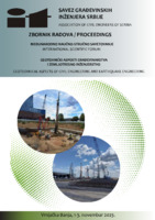
Geotehnički aspekti izgradnje visećeg pešačkog mosta u Starom gradu u Užicu
U radu su prikazani rezultati geotehničkih istraživanja za potrebe izgradnje visećeg pešačkog mosta preko klisure reke Đetinje u Užicu. Predviđeno je da most, sistema prednapregnute trake, omogući prelaz pešacima sa desne dolinske strane na stranu Starog grada, koja je opasana strmom liticom (cca. 40 m visine). Za potrebe formiranja geotehničkog modela i strukturnog sklopa krečnjačke stenske mase korišćen je postupak fotogrametrijskog snimanja dronom. Predviđeno je da se zatežuća sila (od oko 30 MN), koju most prenosi na obalni stub, ...fotogrametrija, stabilnost kosina, pukotine, prednapregnuta sidra, test granične nosivosti, paker (Ližonov) test... investigations performed for the construction of pedestrian suspension bridge, crossing the Đetinja river in the town of Užice. The prestressed ribbon type bridge should connect the right bank of the river with the the vertical clifF (approx. 40 m high) where the Old town is located. Geotechnical model ...Zoran Berisavljević, Miloš Marjanović, Uroš Đurić. "Geotehnički aspekti izgradnje visećeg pešačkog mosta u Starom gradu u Užicu" in Zbornik radova / Međunarodno naučno-stručno savetovanje Geotehnički aspekti građevinarstva i zemljotresno inženjerstvo, Vrnjačka banja, 1-3. novembar 2023., Beograd : Savez građevinskih inženjera Srbije (2023.)
-
Environmental flows and demands for sustainable water use in protected karst areas of the Western Balkans
Karst terrains cover some 30% of the Western Balkans, where rich karst aquifers represent the main source of potable water supply and ensure the development of local economies and tourism. In this “classical karst” region, there are also numerous sites or areas under different forms of protection—from those that are included in the UNESCO World Heritage list to natural monuments and landscapes that are protected by national legislation. In and around them are specific representatives of flora and fauna ...Zoran Stevanović, Aleksandra Maran Stevanović, Želimir Pekaš, Romeo Eftimi, Veljko Marinović. "Environmental flows and demands for sustainable water use in protected karst areas of the Western Balkans" in Carbonates and Evaporites, Springer Science and Business Media LLC (2021). https://doi.org/10.1007/s13146-021-00754-1
