Претрага
667 items
-
WebGIS Cadastre of Abandoned Mines in Autonomous Province of Vojvodina
Ranka Stanković, Nikola Vulović, Nikola Lilić, Ivan Obradović, Radule Tošović, Milica Pešić-Georgiadis (2015)... (USA) includes information on abandoned mines that are in need of remediation, and the mines which were recultivated, that is, where the remediation process was completed [5]. U.S. Geoscience Information Network, USGIN is the federal framework for the exchange of information using the free ...
... well as specific information related to the terrain of abandoned mines [7]. Spatial data in the aforementioned study on terrain of abandoned mines as well as data concerning the remediation of this terrain were generally available. However databases of geographic information systems were often ...
... [2] by the European Parliament and the Council of Europe in European Union member countries, the infrastructure was established for spatial information records with the aim of improving environmental policy, that is policies and actions that have an impact on the environment (INSPIRE). Emphasis ...Ranka Stanković, Nikola Vulović, Nikola Lilić, Ivan Obradović, Radule Tošović, Milica Pešić-Georgiadis. "WebGIS Cadastre of Abandoned Mines in Autonomous Province of Vojvodina" in Proceedings of the 5th International Symposium Mining And Environmental Protection,June 10-13,2015, Vrdnik, Serbia, Belgrade : Faculty of Mining and Geology (2015)
-
Razvoj ARCGIS geobaze površinskog kopa korišćenjem UML CASE alata
... Aleksandra Tomašević, Ljiljana Kolonja, Ivan Obradović, Ranka Stanković, Olivera Kitanović1 ABSTRACT Opportunities offered by geographic information systems are very modestly exploited in Serbian mining industry. It is the authors’ wish to bring closer to the mining public at least a small part ...
... outline of the way spatial-temporal data are handled, as well as by an example of visualization of spatial classes in ArcMap. Keywords: geographic information system, GIS, geodatabase, UML, ArcGIS, open pit INTRODUCTION The growing complexity of engineering tasks creates a need for tools that offer ...
... offer possibilities for high quality situation monitoring and comprehension, as well as prediction of our future line of action. Geographic information systems (GIS) are precisely such a tool. They offer support for implementation of various types of projects aimed at economic development, resource management ...Aleksandra Tomašević, Ljiljana Kolonja, Ivan Obradović, Ranka Stanković, Olivera Kitanović. "Razvoj ARCGIS geobaze površinskog kopa korišćenjem UML CASE alata" in Podzemni radovi, Beograd : Univerzitet u Beogradu - Rudarsko-geološki fakultet (2012)
-
Дефинисање археолошких објеката на локалитету Кремените њиве применом Ојлерове 3Д деконволуције на магнетометријске податке
... of Kremenite njive is located in the settlement Barajevo near Belgrade (Serbia). Applied magnetic investigations were supposed to provide information on the dimensions and most probable depths on which archaeological objects are located, whose presence is assumed on the basis of earlier ar ...
... e tangents procedure, which, although significantly improved compared to the original graphic procedu‐ res (Eppelbaum, 2015), give about 25% information on the depth of the source of magnetic anomalies (Isles & Rankin, 2013). In recent years, an algorithm has been developed that enables a rapid ...
... urther archaeological and geophysical research at this site. ACKNOWLEDGMENT This study was supported by the Serbian Ministry of Education, Science and Technological De‐ velopment, (project No. 176016). LITERATURA / REFERENCES Bastani, M., Kero, L., 2004. Test of the analytical signal ...Весна Цветков, Илија Васиљевић, Бранислав Сретеновић, Весна Дамњановић. "Дефинисање археолошких објеката на локалитету Кремените њиве применом Ојлерове 3Д деконволуције на магнетометријске податке" in Књига апстраката 17. Конгрес геолога Србије, Врњачка Бања 17-20. мај, Српско геолошко друштво (2018)
-
Improvement of geodatabase queries within GeolISS
Ranka Stanković (2008)... [11] Krstev C., Pavlović-Lažetić G., Vitas D., Obradović I.: “Using Textual and Lexical Resources in Developing Serbian Wordnet”, Romanian J. Information Science and Technology, Romanian Academy, vol. 7, No. 1–2, pp. 147–161, (2004) [12] Krstev, C., Vitas, D., Maurel, D., Tran, M. (2005). “Multilingual ...
... other features. A geographic or geospatial information system (GIS) is a system for capturing, storing, analyzing, managing and presenting spatially (georeferenced) data and related attributes. Modern GIS technologies are based on digital information, with various methods used for creating digital ...
... Human Language Technology Group at the University of Belgrade can be used for improvement of queries for the geodatabase within the Geological information system of Serbia (GeolISS). The first section of this paper introduces the approach to GeolISS development, whose main goal is the integration ...Ranka Stanković. "Improvement of geodatabase queries within GeolISS" in Review of the National Center for Digitization, Beograd : Faculty of Mathematics, Belgrade (2008)
-

Prvi nalazi repatih vodozemaca (Urodela) u pleistocenskoj pećinskoj fauni Srbije; još jedna kockica u slagalici
Fosilna fauna pleistocenskih pećina odslikava sastav faune njihove okoline. Najčešće se u njima naleze ostaci krupnih sisara ledenog doba koji su je koristili kao stanište. Uz njih česti su i ostaci drugih sitnih kičmenjaka kao što su sitni sisari, ribe, vodozemci, gmizavci i ptice. Ostaci sitnih kičmenjaka u većini slučajeva u pećinu dospevaju kao plen grabljivica (ptice i sisari) ali je manji broj njih pećinu koristio i kao sklonište ili stanište. U proučavanje fluktuacija pleistocenske klime sve češće se ...... another piece of the puzzlie of our interpretation of paleoenvironments. Acknowledgement: This work was funded through the NEEMO Project of the Science Fund ofthe Republic of Serbia, namber 7746827. 46 BOSNEIHERCEGOMINE =–Dragana Đurić, Katarina Bogićević, Draženko Nenadić, Mihajlo Jovanović, Aleksandra Savković. "Prvi nalazi repatih vodozemaca (Urodela) u pleistocenskoj pećinskoj fauni Srbije; još jedna kockica u slagalici" in Zbornik sažetaka III Kongresa geologa Bosne i Hercegovine sa međunarodnim učešćem. Neum, 21.-23. septembar/rujan 2023, Ilidža : Udruženje geologa Bosne i Hercegovine (2023)
-

Flyrock induced by blasting in surface mining
Milanka Negovanović, Lazar Kričak, Snežana Ignjatović, Stefan Milanović, Jovan Marković, Nikola Simić, Rade Šarac (2022)Miniranje predstavlja i dalje najefikasniji i najjeftiniji način eksploatacije velikih količina čvrstih mineralnih sirovina na površinskim kopovima. Energija eksplozije se koristi za fragmentaciju čvrste stenske mase do zahtevane granulacije. Pored pozitivnih efekata miniranja, postoje i određeni neželjeni efekti svakog procesa miniranja koji se mogu javiti, a to su: potresi tla, razletanje komada stene, vazdušni udari, otrovni i zagušljivi gasovi i prašina. Razletanje komada stene je nekontrolisano izbacivanje fragmenata odminirane stenske mase i predstavlja jedan od glavnih izvora materijalne štete ...Milanka Negovanović, Lazar Kričak, Snežana Ignjatović, Stefan Milanović, Jovan Marković, Nikola Simić, Rade Šarac. "Flyrock induced by blasting in surface mining" in Rudarski glasnik, Beograd : Rudarski institut (2022). https://doi.org/10.25075/BM.2022.05
-

Data from the Digital Repository of the Faculty of Mining and Geology in eScience (eNauka)
Biljana Rujević, Mihailo Škorić (2024)The paper describes linking the Digital Repository of the University of Belgrade, Faculty of Mining and Geology, with the eScience system in terms of transferring metadata about the results of researchers' scientific work. The steps taken to ensure a smooth harvesting of metadata are outlined. Additionally, a presentation of additional improvements to the OAI system is provided, aiming to contribute to the automatic linking of authors with their results in the eScience system.Biljana Rujević, Mihailo Škorić. "Data from the Digital Repository of the Faculty of Mining and Geology in eScience (eNauka)" in Infotheca, Faculty of Philology, University of Belgrade (2024). https://doi.org/10.18485/infotheca.2023.23.2.4
-
Application of Expansive Mortars for the Formation of Artificial Screens During Blasting in Urban Areas
During construction of buildings in urban areas, sometimes there is a need to blast solid rock mass in the immediate vicinity of the surrounding buildings. In that case, the aim is not only to increase the efficiency of blasting, but also to reduce harmful effects of ground vibration induced by blasting. At the same time, it is very important to protect the buildings located in the safe zone from the blast site as well as remaining rock mass around ...Milanka Negovanović, Lazar Kričak, Stefan Milanović, Nikola Simić, Jelena Majstorović. "Application of Expansive Mortars for the Formation of Artificial Screens During Blasting in Urban Areas" in 31st International Conference Ecological Truth & Environmental Research-EcoTER'24, Sokobanja, 18-21. jun 2024, Bor : Tehnički fakultet u Boru (2024)
-
Concepts for Improving Machine Learning Based Landslide Assessment
Miloš Marjanović, Mileva Samardžić Petrović, Biljana Abolmasov, Uroš Đurić. "Concepts for Improving Machine Learning Based Landslide Assessment" in Natural Hazards GIS-based Spatial Modeling Using Data Mining Techniques, Advances in Natural and Technological Hazards Research, volume 48, Springer Nature Switzerland AG 2019 (2019). https://doi.org/10.1007/978-3-319-73383-8_2
-
Machine learning based landslide assessment of the Belgrade metropolitan area: Pixel resolution effects and a cross-scaling concept
Improvements of Machine Learning-based landslide prediction models can be made by optimizing scale, customizing training samples to provide sets with the best examples, feature selection, etc. Herein, a novel approach, named Cross-Scaling, is proposed that includes the mixing of training and testing set resolutions. Hypothetically, training on a coarser resolution dataset and testing the model on a finer resolution should help the algorithm to better generalize ambiguous examples of landslide classes and yield fewer over/underestimations in the model. This ...Uroš Đurić, Miloš Marjanović, Zoran Radić, Biljana Abolmasov. " Machine learning based landslide assessment of the Belgrade metropolitan area: Pixel resolution effects and a cross-scaling concept" in Engineering Geology , Elsevier (2019). https://doi.org/10.1016/j.enggeo.2019.05.007
-
Critical disorder and critical magnetic field of the nonequilibrium athermal random-field Ising model in thin systems
Svetislav Mijatović, Dragutin Jovković, Sanja Janićević, Đorđe Spasojević. "Critical disorder and critical magnetic field of the nonequilibrium athermal random-field Ising model in thin systems" in Physical Review E, American Physical Society (APS) (2019). https://doi.org/10.1103/PhysRevE.100.032113
-
Rock slope stability analysis under Hoek–Brown failure criterion with different flow rules
The stability analysis of homogeneous rock slope following the Hoek–Brown failure criterion under the hypothesis of different flow rules is performed based on limit equilibrium and finite element methods. The applied failure criterion is the generalized Hoek–Brown that can be introduced as a shear/normal function in analysis applying different flow rules. The results are compared with those obtained by the application of equivalent shear strength parameters of the Mohr–Coulomb criterion, considering that this is still the most widely used ...Kružna klizna površ, Huk-Braunov kriterijum loma, Kriterijum popuštanja, Smičuća/normalna funkcija, Nivo napona, Verovatnoća i parametarska analizaSvetlana Melentijević, Zoran Berisavljević, Dušan Berisavljević, Claudio Olalla Marañón . "Rock slope stability analysis under Hoek–Brown failure criterion with different flow rules" in Bulletin of Engineering Geology and the Environment , Springer (2024). https://doi.org/10.1007/s10064-024-03667-0
-
A Multilingual Evaluation Dataset for Monolingual Word Sense Alignment
Sina Ahmadi, John P McCrae, Sanni Nimb, Fahad Khan, Monica Monachini, Bolette S Pedersen, Thierry Declerck, Tanja Wissik, Andrea Bellandi, Irene Pisani, [...] Ranka Stanković and others (2020)Aligning senses across resources and languages is a challenging task with beneficial applications in the field of natural language processing and electronic lexicography. In this paper, we describe our efforts in manually aligning monolingual dictionaries. The alignment is carried out at sense-level for various resources in 15 languages. Moreover, senses are annotated with possible semantic relationships such as broadness, narrowness, relatedness, and equivalence. In comparison to previous datasets for this task, this dataset covers a wide range of languages ...... Ponzetto, 2012), seman- tic role labeling (Palmer, 2009) and information extraction (Moro et al., 2013). Moreover, combining LSRs can en- hance domain coverage in terms of the number of lexical items and types of lexical-semantic information (Shi and * Contact Authors 1https://globalex2020.globalex ...
... it possible to combine verb groups and dictio- nary valency information, used as input for the compilation of the Danish FrameNet Lexicon (Nimb, 2018). Further- more, they constitute the basis for the automatically inte- grated information on related words in DDO, on the fly for each dictionary sense ...
... resources such as word- nets and encyclopedia have significant differences in struc- ture and heterogeneity in content, which makes aligning information across resources and languages a challenging task. Word sense alignment (WSA) is a more specific task of linking dictionary content at sense level ...Sina Ahmadi, John P McCrae, Sanni Nimb, Fahad Khan, Monica Monachini, Bolette S Pedersen, Thierry Declerck, Tanja Wissik, Andrea Bellandi, Irene Pisani, [...] Ranka Stanković and others . "A Multilingual Evaluation Dataset for Monolingual Word Sense Alignment" in Proceedings of the 12th Conference on Language Resources and Evaluation (LREC 2020), Marseille, European Language Resources Association (ELRA) (2020)
-
LRMI markup of OER content within the BAEKTEL project
... Linked Open Data, 2015, Springer Science+Business Media New York. [10] Nelson, P., Edmundo, T., Ricardo C.P., Jorge, L.V., Janneth, A.C., "Consuming and producing linked open data: the case of OpenCourseWare", Program: electronic library and information systems, Vol. 48 Iss: 1, pp.16 - ...
... eventually additional front end clients. This API returns course information from all current Course documents available in edX-platform, including a comprehensive set of course information, including enrollment information, configurable marketing copy, and so on. Figure 2: LRMI tagging ...
... BMP integrates also web services for terminological and linguistic support, such as query expansion, information retrieval, OER indexing, and the like. OER metadata include information such as resource title, author, subject, creation date and the like, which facilitates search, but also ...Ranka Stanković, Daniela Carlucci, Olivera Kitanović, Nikola Vulović, Bojan Zlatić. "LRMI markup of OER content within the BAEKTEL project" in The Sixth International Conference on e-Learning (eLearning-2015), September 2015, Belgrade, Serbia, Belgrade : Belgrade Metropolitan Univesity (2015)
-
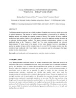
Coal homogenization stockyard sizing “Tamnava – Zapad” case study
... Stanković R., Knežević D., Jovanović M., “Application of stochastic models for mine planning and coal quality control”, ISSN 0354-9836, Thermal science, Vol. 18., No. 4, 2014, pp.1361-1372, DOI: 10.2298/TSCI130201031S 9. Zhao, S., Lu, T.F., Koch, B. and Hurdsman, A., 2015. 3D stockpile modelling ...Božo Kolonja, Dinko Knežević, Ranka Stanković, Dejan Stevanović, Detlef Trummer. "Coal homogenization stockyard sizing “Tamnava – Zapad” case study" in Proceedings of 13th International Symposium Continuous Surface Mining, ISCSM 2016, / (2016)
-
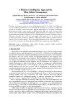
A business intelligence approach to mine safety management
Ljiljana Kolonja, Ranka Stanković, Ivan Obradović, Olivera Kitanović, Dejan Stevanović, Marija Radojičić (2016)... the past decade. In general, ICT is introduced in various mining engineering systems most often in the form of information systems, with the basic goal to secure reliable information for managers and decision makers. In addition to that, different ICT support systems and tools have been developed ...
... injury within the leg category (Figure 4 left). A time dimension can also be added, and all this information can be viewed by months, trimesters, years, or within a specific time period. This information enables preventive action with the aim of raising the level of safety equipment for body parts ...
... sets of information to improve and support their working tasks. Traditionally, available data is limited to queries or reports which have been predefined for them by IT experts. Business intelligence offers some novel approaches to presentation and analysis of business information. The field ...Ljiljana Kolonja, Ranka Stanković, Ivan Obradović, Olivera Kitanović, Dejan Stevanović, Marija Radojičić . "A business intelligence approach to mine safety management" in 13th International Symposium Continuous Surface Mining, Beograd : Yugoslav Opencast Mining Committee (2016)
-
A hydrogeological model of the open-cast mine Tamnava - West Field (Kolubara Coal Basin, Serbia)
... from groundwater, as well as the selection of an optimal dewatering system. ACKNOWLEDGEMENT Our gratitude goes to the Ministry of Education, Science and Technological Development of the Republic of Serbia for funding projects OI176022, TR33039, TR37005 and III43004. REFERENCES BAJIĆ, D ...Jelena Ratković, Dušan Polomčić, Dragoljub Bajić, Bojan Hajdin. "A hydrogeological model of the open-cast mine Tamnava - West Field (Kolubara Coal Basin, Serbia)" in Underground Mining Engineering no. 29, Belgrade : University of Belgrade - Faculty of mining and geology (2016): 43-54
-
The different approaches in seismic stratigraphy interpretation
Dejan Radivojević (2018)U tekstu su prikazana dva osnovna pristupa u seizmostratigrafskoj interpretaciji. Prvi kao polaznu osnovu ima seizmičke sekcije, čija se interpretacija u kasnijoj fazi koreliše sa bušotinskim podacima. Drugi u prvoj fazi analizira podatke dobijene dubokim bušenjem koji se kasnije korelišu sa seizmičkim sekcijama. Prikazan je hronološki redosled i objašnjen postupak pri seizmostratigrafskoj interpretaciji oba pristupa. Ovakav način interpretacije omogućio je naftnim kompanijama detaljnije i preciznije sagledavanje geoloških odnosa, smanjenje rizika istraživanja i racionalnije projektovanje razradnih bušotina.seizmostratigrafija, istraživanje nafte i gasa, karakteristične seizmičke sekvence, seiz-mofacijalna analiza... Catuneanu O, Principles of Sequence Stratigraphy, Elsevier, pp 375, Amsterdam, 2007. [2] Emery D. & Myers K. J, Sequence Stratigraphy, Bla- ckwell Science, pp 297, Oxford, 2001. [3] Mitchum R. M. Jr. & Vail P. R, Seismic stratigraphy nad global changes of sea level, part 7: stratigraphic interpretation ...Dejan Radivojević. "The different approaches in seismic stratigraphy interpretation" in Tehnika – rudarstvo, geologija i metalurgija, Savez inženjera i tehničara Srbije, Beograd (2018). https://doi.org/10.5937/tehnika1802211R
-
Izbor rotornih bagera za proces revitalizacije: primer rotornih bagera SRs 1200 u rudarskom basenu Kolubara
Predrag Jovančić, Dragan Ignjatović, Stevan Đenadić, Filip Miletić, Goran Todorović, Dragan Novaković (2020)Revitalizacija je proces ili skup tehničkih zahvata na mašini kojim se vrši zamena svih dotrajalih ili oštećenih delova metalne konstrukcije. Sastavni deo procesa revitalizacije je i modernizacija zastarele elektro-mašinske opreme. Principi revitalizacije sasvim sigurno nisu sadržani u okviru redovnog godišnjeg ili dnevnog održavanja. Oni predstavljaju održavanje onih veličina koje su značajne za mašinu kao celinu (u ovom slučaju rotorni bager). U ovom radu su analizirani rotorni bageri oznake SRs 1200. Na površinskim kopovima rudarskog basena Kolubara takvih bagera ima ...Predrag Jovančić, Dragan Ignjatović, Stevan Đenadić, Filip Miletić, Goran Todorović, Dragan Novaković. "Izbor rotornih bagera za proces revitalizacije: primer rotornih bagera SRs 1200 u rudarskom basenu Kolubara" in XIV Međunarodna konferencija OMC 2020, Zlatibor, Srbija, 14-17. oktobar 2020., Jugoslovenski komitet za površinsku eksploataciju (2020)
-
Sitni, ali bitni: uloga sitnih sisara, herpetofaune i mekušaca u rekonstrukciji pleistocenskih paleosredina
Fosilni ostaci životinja i biljaka imaju važnu ulogu u rekonstrukciji pleistocenskih paleosredina. U ovom radu opisan je značaj tri grupe životinja: sitnih sisara, herpetofaune I mekušaca. Mada je za rekonstrukciju važan sastav čitave asocijacije, nalasci pojedinih vrsta mogu biti dovoljno indikativni da otkriju tip staništa ili klimatske uslove. Posebnu teškoću pri rekonstrukciji paleosredina u Srbiji predstavlja činjenica da klimatske promene na Balkanskom poluostrvu nisu bile tako oštre kao u srednjoj i zapadnoj Evropi, pa ne postoji drastična razlika u ...... the reconstruction of palaecoenvironments, especially palaeoclimatic conditions. Characteristic species or index-fossils can provide valuable information about the climatic characteristics of an area, since certain species are specially adapted to cold or warm climate. Thus, for example, it can ...
... geochemical studies of oxygen isotopes in mollusc shells. Analyzing the isotopic composition of shells from successive lineages can provide not only information on seasonal climate variations, but also data on global climate changes. Based on the remains of molluscs, other significant data useful for ...
... it is useful to combine different types of methods for greater accuracy. Acknowledgement: This work was funded through the NEEMO Project of the Science Fund ofthe Republic of Serbia, nuamber 7746827. 52 III KONGRES GE0LOGR BOSNE I HERCEGOVMINE SR MEBUNRRODNIM UČEŠĆEM References: 1. ...Katarina Bogićević, Draženko Nenadić, Dragana Đurić, Mihajlo Jovanović, Aleksandra Savković. "Sitni, ali bitni: uloga sitnih sisara, herpetofaune i mekušaca u rekonstrukciji pleistocenskih paleosredina" in Zbornik sažetaka III Kongresa geologa Bosne i Hercegovine, Neum, 21.-23.09.2023., Ilidža : Udruženje geologa Bosne i Hercegovine (2023)