Претрага
328 items
-
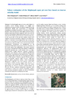
Failure Estimation of the Majdanpek Open Pit East Face Based on Inverse Velocity Model
The Majdanpek open pit mine south district is currently active mining prospect of copper ore exploitation in eastern Serbia. Its depth is approaching the termination depth and occurrences of large-scale instabilities and global instability of the final pit slope is possible. These can generate catastrophic mass movement inside an area that encloses a regional road route and the Pek River bed which is channelled along the outer contour of the pit. The displacements that were noted in early 2023, in the ...Miloš Marjanović, Stefan Milanović, Nikola Simić, Lazar Kričak. "Failure Estimation of the Majdanpek Open Pit East Face Based on Inverse Velocity Model" in Regional Symposium on Landslides in the Adriatic-Balkan Region, Belgrade, 15-18th May 2024, University of Belgrade, Faculty of Mining and Geology (2024). https://doi.org/10.18485/resylab.2024.6.ch46 М33
-

Wells calculation for the protection of opencast mine Radljevo North from groundwater
Za projektovanje kvalitetnog sistema zaštite jednog površinskog kopa od podzemnih voda bitno je da ulazni podaci budu verodostojni, kako bi se na osnovu njih izvršili potrebni proračuni objekata odvodnjavanja podzemnih voda. Proračunima za površinski kop Radljevo Sever je omogućeno da se dobije potreban broj bunara kako bi oni pravilno funkcionisali i obezbedili potrebno obaranje podzenih voda.Dušan Polomčić, Vladimir Petković, Miloš Jeremić. "Wells calculation for the protection of opencast mine Radljevo North from groundwater" in XIII Međunarodna konferencija OMC, Zlatibor, 2018, Jugoslovenski komitet za površinsku eksploataciju (2018) М33
-

Tektonska analiza područja Javrorja - Jugozapadna Srbija
Miloš Filipović (2024)U ovom radu autor primenom različitih metodoloških postupaka i različitih podataka ima zadatak da što detaljnije prikaže složenu i polifaznu tektonsku građu evoluciju ovog dela Dinarida i Srbije. Tektonska analiza podrazumeva statističku obradu strukturnih podataka. Teren pokrivaju dve tektonske jedinice Istočnobosansko- durmitorska jedinica i Zapadno- vardarski ofioliti. Zasebno su anlizirani i diskutovani rupturni i plikativni sklop. U okviru analize rupturnog sklopa dat je i kratak prikaz neotektonskog sklopa sa izrađenim kartama enrgije reljefa i karte I trenda energije reljefa. ...Miloš Filipović. Tektonska analiza područja Javrorja - Jugozapadna Srbija, 2024
-
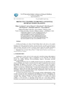
Protective channels to prevent a potential rockfall during blasting
Miljan Gomilanović, Stefan Milanović, Nikola Stanić, Miloš Živanović, Saša Stepanović, Aleksandar Doderović, Tanja Stanković (2024)Drilling and blasting at the Open Pit North Mining District takes place in the complex geological and urban environment conditions. The proximity of the city requires the performance of mining works with application the numerous and strict protection measures against the negative impact of mining. This paper presents a protection measure against the possible movement of loose pieces of rock that may occur as a result of blasting by creating the protective channels.open pit north mining district, rockfall during blasting, special protection measures, protective channelsMiljan Gomilanović, Stefan Milanović, Nikola Stanić, Miloš Živanović, Saša Stepanović, Aleksandar Doderović, Tanja Stanković. "Protective channels to prevent a potential rockfall during blasting" in The 55th international october conference on mining and metallurgy, Kladovo, Serbia, 15 - 17 october 2024, Mining and metallurgy institute Bor (2024). https://doi.org/10.5937/IOC24087T М33
-
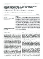
Stratigraphic implications of the Mio-Pliocene geodynamics in the area of Mt. Avala: new evidence from Torlak Hill and Beli Potok (Belgrade, Serbia)
Mt. Avala is located on the southern margin of the Pannonian basin (SPB), a border zone between the uplifted morphostructures of the Dinarides and Carpathian-Balkanides. Similar to the Pannonian basin, tectonostratigraphic evolution of the Mt. Avala area during the last 23 Ma has is characterized by syn- and post-rifting processes as well as tectonic inversion. Here, we present the results of field investigations of the Miocene‒Pliocene dynamics that led to different spatial positions of the same stratigraphic units (e.g. ...Ljupko Rundić, Meri Ganić, Slobodan Knežević, Dejan Radivojević, Miloš Radonjić. "Stratigraphic implications of the Mio-Pliocene geodynamics in the area of Mt. Avala: new evidence from Torlak Hill and Beli Potok (Belgrade, Serbia)" in Geologia Croatica (2019). https://doi.org/10.4154/gc.2019.11 М22
-
Машински елементи - приручник
Милош Танасијевић, Филип Милетић (2022)Милош Танасијевић, Филип Милетић. Машински елементи - приручник, Београд : Универзитет у Београду, Рударско-геолошки факултет, 2022 Без категорије
-

Regional rockfall exposure assessment, experience from Serbia
Rockfalls are common in hilly and mountainous areas, especially along roads with engineered slopes and cuts. Such is the case for most of the state and local road routes in Central, Serbia, which was the subject in this case study. A road network of 276 km covering roughly 1700 km2 between the cities of Kraljevo, Čačak and Ivanjica is presented. Assessing of such wide areas needs to be conducted from large to site-specific scale, i.e., using GIS spatial tools ...Miloš Marjanović, Biljana Abolmasov, Uroš Đurić, Jelka Krušić, Snežana Bogdanović. "Regional rockfall exposure assessment, experience from Serbia" in 5th Regional symposium on landslides in Adriatic–Balkan Region, 23-26 March 2022, Faculty of Civil Engineering, University of Rijeka and Faculty of Mining, Geology and Petroleum Engineering, University of Zagreb (2022) М33
-
Assessing Criteria Weights by the Symmetry Point of Criterion (Novel SPC Method) - Application in the Efficiency Evaluation of the Mineral Deposit Multi-Criteria Partitioning Algorithm
Information about the relative importance of each criterion or the weights of criteria can have a significant influence on the ultimate rank of alternatives. Accordingly, assessing the weights of criteria is a very important task in solving multi-criteria decision-making problems. Three methods are commonly used for assessing the weights of criteria: objective, subjective, and integrated methods. In this study, an objective approach is proposed to assess the weights of criteria, called SPC method (Symmetry Point of Criterion). This point ...Вишекритеријумско одлучивање, тежине критеријума, тачка симетрије критеријума, налазиште минерала, алгоритам, процена учинкаZoran Gligorić, Miloš Gligorić, Igor Miljanović, Suzana Lutovac, Aleksandar Milutinović. "Assessing Criteria Weights by the Symmetry Point of Criterion (Novel SPC Method) - Application in the Efficiency Evaluation of the Mineral Deposit Multi-Criteria Partitioning Algorithm" in Computer Modeling in Engineering & Sciences (2023). https://doi.org/10.32604/cmes.2023.025021 М22
-
Laboratory testing of fly ash
Fly ash is one of the most common waste materials created by burning of coal. It is composed of smaller particles, consisting mainly of aluminosilicate glass, mullite and quartz, which are collected by electrostatic separators (filter) of gaseous products arising from the combustion of coal. This paper presents the pozzolanic properties, mechanical properties, chemical and mineral composition of fly ash obtained in the combustion process in a power plant Nikola Tesla A (PPNT A) with the addition of a ...chemical composition, fly ash, mechanical properties, mineral properties, pozzolanic properties, X-ray diffractionMiloš Šešlija, Aleksandra Rosić, Nebojša Radović, Milinko Vasić, Mitar Đogo, Milovan Jotić. "Laboratory testing of fly ash" in Tehnički vijesnik (2016). https://doi.org/10.17559/TV-20150317171035 M23
-
Preliminary regional landslide susceptibility assessment using limited data
Igor Peshevski, Milorad Jovanovski, Biljana Abolmasov, Jovan Papic, Uroš Đurić, Miloš Marjanović, Ubydul Haque, Natasha Nedelkovska (2019)In this paper a heuristic approach for preliminary regional landslide susceptibility assessment using limited amount of data is presented. It is called arbitrary polynomial method and takes into account 5 landslide conditioning parameters: lithology, slope inclination, average annual rainfall, land use and maximum expected seismic intensity. According to the method, in the first stage, a gradation is performed for each of the carefully selected conditioning parameters by assigning so called rating points to the grid cells on which the ...Igor Peshevski, Milorad Jovanovski, Biljana Abolmasov, Jovan Papic, Uroš Đurić, Miloš Marjanović, Ubydul Haque, Natasha Nedelkovska. "Preliminary regional landslide susceptibility assessment using limited data" in Geologica Croatica , Croatian Geological Society (2019). https://doi.org/10.4154/gc.2019.03 М23
-
Quantitative landslide risk assessment in the city of Tuzla
In the climate-changing conditions, geological environment interacts more dramatically with the urban fabric than before. The urbanization is expansive and more aggressive than before, but so are the weather extremes and long-term climate trends. In effect, many processes which can be triggered by either side, nature or engineering, are becoming more pervasive than before, and such is the case with landslides. Dealing and managing landslides requires few crucial steps, starting from collecting data on landslide location and typology – ...Miloš Marjanović, Biljana Abolmasov, Cvjetko Sandić, Miralem Mulać, Petar Begović. "Quantitative landslide risk assessment in the city of Tuzla" in SCG-Xiii International Symposium on Landslides. Cartagena, Colombia- February 22-26, 2021, International Society for Soil Mechanics and Geotechnical Engineering (2021) М33
-
Ground surface subsidence monitoring using sentinel-1 in the “Kostolac” open pit coal mine
Zoran Gojković, Milan Kilibarda, Ljiljana Brajović, Miloš Marjanović, Aleksandar Milutinović, Aleksandar Ganić (2023)Open pit coal mining affects surrounding populated areas, resulting in terrain surface deformation. Surface deformation should be monitored as often as possible to control deformations and prevent potential incidents. This paper analyzes time series deformation estimated from the Sentinel-1 satellite images using the Persistent Scatterer Interferometry method to monitor subsidence rates caused by open pit mining activities. It is possible to measure deformations using classical geodetic methods, but those are rarely used in practice because they are time-consuming and ...Zoran Gojković, Milan Kilibarda, Ljiljana Brajović, Miloš Marjanović, Aleksandar Milutinović, Aleksandar Ganić. "Ground surface subsidence monitoring using sentinel-1 in the “Kostolac” open pit coal mine" in Remote Sensing (2023). https://doi.org/10.3390/rs15102519 М21
-
Geotehnički aspekti izgradnje visećeg pešačkog mosta u Starom gradu u Užicu
U radu su prikazani rezultati geotehničkih istraživanja za potrebe izgradnje visećeg pešačkog mosta preko klisure reke Đetinje u Užicu. Predviđeno je da most, sistema prednapregnute trake, omogući prelaz pešacima sa desne dolinske strane na stranu Starog grada, koja je opasana strmom liticom (cca. 40 m visine). Za potrebe formiranja geotehničkog modela i strukturnog sklopa krečnjačke stenske mase korišćen je postupak fotogrametrijskog snimanja dronom. Predviđeno je da se zatežuća sila (od oko 30 MN), koju most prenosi na obalni stub, ...fotogrametrija, stabilnost kosina, pukotine, prednapregnuta sidra, test granične nosivosti, paker (Ližonov) testZoran Berisavljević, Miloš Marjanović, Uroš Đurić. "Geotehnički aspekti izgradnje visećeg pešačkog mosta u Starom gradu u Užicu" in Zbornik radova / Međunarodno naučno-stručno savetovanje Geotehnički aspekti građevinarstva i zemljotresno inženjerstvo, Vrnjačka banja, 1-3. novembar 2023., Beograd : Savez građevinskih inženjera Srbije (2023.) М33
-
Анализа одрона у стенским косинама: савремени приступи
Милош Марјановић (2023)У Србији и региону познате су бројне појаве одрона које су изазвале велике застоје саобраћаја, материјалне штете или чак имале фаталне исходе, па их је потребно непрестано пратити и изучавати. Mодeловањe одрона скопчано је са ниским нивоом поузданости, али савремене технологије омогућавају да сe такви изгледи донекле побољшају. Једна од технологија која чини искорак утом правцу јe LiDAR-ско скенирање, које обезбеђује детаљне топографске подлоге у виду облака тачака високе резолуције и тачности. Поступак анализе одрона може се свести на: ...Милош Марјановић. "Анализа одрона у стенским косинама: савремени приступи" in Записници Српског геолошког друштва, Београд : Српско геолошко друштво (2023) М51
-
Interpretation of Trace Element Chemistry of Zircons from Bor and Cukaru Peki: Conventional Approach and Random Forest Classification
Dina Klimentyeva, Milos Velojic , Albrecht Von Quadt, Shawn Hood. "Interpretation of Trace Element Chemistry of Zircons from Bor and Cukaru Peki: Conventional Approach and Random Forest Classification" in Geosciences (2022). https://doi.org/https://doi.org/10.3390/geosciences12110396 М23
-
Geotehnički uslovi rekonstrukcije Zavičajnog muzeja u Jagodini
Milan Tokanović (2024)U radu su prikazana geotehnička istraživanja za potrebe rekonstrukcije Zavičajnog muzeja Jagodina.Zavičajni muzej u ulici Kneginje Milice br.82 u Jagodini, ima ozbiljna oštećenja pojedinih delova konstrukcije koja su nastala na objektu tokom više od 80 godina eksploatacije.Kako bi se trajno rešio problem dinamičke stabilnosti i statičke održivosti konstruktivnog sistema objekta,neophodno je bilo definisanje geotehničkih uslova u zoni interakcije prirodne sredine i konstrukcije predmetnog objekta.Izvedena su terenska i laboratorijska ispitivanja na osnovu kojih su dobijene geotehničke podloge. Na osnovu dobijenih geotehničkih podloga ...geotehnička istraživanja, Zavičajni muzej, temelji, fundiranje, nosivost, sleganje, istražne jame, laboratorijska geomehanička ispitivanja, JagodinaMilan Tokanović. Geotehnički uslovi rekonstrukcije Zavičajnog muzeja u Jagodini, 2024
-
Properties of fly ash and slag from the power plants
This paper describes the physical, chemical and mineral properties of ash and slag, which were taken from thermal power plants Nikola Tesla A, Nikola Tesla B, Kostolac A and Kostolac B. The knowledge of the mineralogical material composition is important because the type of minerals directly determines the properties of the fly ash and slag and their possible application. Laboratory tests showed that ash and slag samples consist of the following minerals: amorphous materials, quartz, feldspar, mullite, melilite, cristobalite, ...fly ash, slag, physical composition, chemical composition, mineral composition, X-ray diffraction methodMiloš Šešlija, Aleksandra Rosić, Nebojša Radović, Milinko Vasić, Mitar Đogo, Milovan Jotić. "Properties of fly ash and slag from the power plants" in Geologia Croatica, Zagreb : Croatian Geological Survey (2016). https://doi.org/10.4154/gc.2016.26 M23
-
Analiza stabilnosti kosine na magistralnom putu M-1, deonica Lipci-Ljuta
Ksenija Gredić (2024)Katedra za Geotehniku održala je sednicu na kojoj mi je odobrena tema za završnirad pod naslovom “Analiza stabilnosti kosine na magistralnom putu M-1, deonica Lipci-Ljuta” u opštini Kotor.Za mentora je izabran van.prof.Miloš Marjanović, dok za članove komisije su izabrani prof.dr. Biljana Abolmasov i doc.dr. Zoran Berisavljević. Tokom izrade završnog rada, korišćeni su podaci iz “Elaborata o rekonstrukciji magistralnog puta M-1 (M-2), dionica Lipci-Ljuta, dužine cca 15km”, kao i ostala odgovarajuća stručna literatura. Na osnovu terenskih radova i dobijenih rezultata ...Ksenija Gredić. Analiza stabilnosti kosine na magistralnom putu M-1, deonica Lipci-Ljuta, 2024
-
Multihazard Exposure Assessment on the Valjevo City Road Network
Miloš Marjanović, Biljana Abolmasov, Svetozar Milenković, Uroš Đurić, Jelka Krušić, Mileva Samardžić Petrović (2019)Miloš Marjanović, Biljana Abolmasov, Svetozar Milenković, Uroš Đurić, Jelka Krušić, Mileva Samardžić Petrović. "Multihazard Exposure Assessment on the Valjevo City Road Network" in Spatial Modeling in GIS and R for Earth and Environmental Sciences, Elsevier Inc (2019). https://doi.org/10.1016/B978-0-12-815226-3.00031-4. М14