Претрага
238 items
-
Fragmentation Size Prediction of Blasted Material Using a Specialized Software for Drilling and Blasting
Stefan Milanović, Nikola Simić, Lazar Kričak, Milanka Negovanović, Nikola Đokić, Miljan Gomilanović (2024)Design and optimizing the drilling and blasting parameters, should fill the requirements for the capacity, fragmentation size, and technical characteristics of loading and transport equipment, and enable a safe work at the open pit. Besides mentioned, it also achieves the minimal impact on the environment of the open pit and decreases the negative effects on the environment, especially in the blast vibration and flyrock. To obtain the best possible blasting effects and consider all the factors, a specialized software is ...Stefan Milanović, Nikola Simić, Lazar Kričak, Milanka Negovanović, Nikola Đokić, Miljan Gomilanović. "Fragmentation Size Prediction of Blasted Material Using a Specialized Software for Drilling and Blasting" in The 55th International October Conference on Mining and Metallurgy, Mining and Metallurgy Institute Bor (2024). https://doi.org/10.5937/IOC24077M М33
-
Konceptualni model hidrogeotermalnog sistema šire okoline Brusa - geološki, geofizički i hidrogeološki uslovi / Conceptual model of hydrothermal system of Brus area - geological, geophysical and hydrogeological condition
Dejan Milenić, Ana Vranješ, Marinko Toljić, Ivana Vasiljević, Natalija Radosavljević, Matija Ognjanović (2024)Na širem području Brusa izvedena su naučna multidisciplinarna istraživanja za potrebe ocene geotermalnog potencijala sa zadatkom de9inisanja uslova formiranja geotermalnih i termomineralnih resursa. Interpretacijom podataka zaključeno je da je na predmetnom terenu formiran "hibridni" hidrogeotermalni sistem, koji sadrži elemente sistema u rov-strukturi i elemente konvektivnog hidrogeotermalnog sistema sa rezervoarom u pokrivaču granitoidne intruzije. Sistem čine dva nezavisna hidrogeotermalna rezervoara. Prvi rezervoar formiran je u gornjokrednim krečnjacima na dubini od oko 1550 m. Maksimalne prognozne temperature hidrogeotermalnih resursa u krečnjačkom ...Dejan Milenić, Ana Vranješ, Marinko Toljić, Ivana Vasiljević, Natalija Radosavljević, Matija Ognjanović. "Konceptualni model hidrogeotermalnog sistema šire okoline Brusa - geološki, geofizički i hidrogeološki uslovi / Conceptual model of hydrothermal system of Brus area - geological, geophysical and hydrogeological condition" in XVII Srpski simpozijum o hidrologiji sa međunarodnim učešćem , Pirot, Srbija, 02-06. October 2024, Beograd : Univerzitet u Beogradu - Rudarsko-geološki fakultet (2024). https://doi.org/10.5281/zenodo.13739406 М63
-
Konceptualni model hidrogeotermalnog sistema šire okoline Brusa - geotermalna karakterizacija sistema / Conceptual model of hydrothermal system of Brus area - system geothermal characterization
Dejan Milenić, Ana Vranješ, Marinko Toljić, Ivana Vasiljević, Natalija Radosavljević, Matija Ognjanović (2024)Postavljeni konceptualni model hidrogeotermalnog sistema Brusa sa širom okolinom testiran je primenom različitih hidrohemijskih i izotopskih metoda u cilju njegove verifikacije i karakterizacije. Rezultati su ukazali na atomsfersko poreklo geotermalnih fluida i na razviće primarnih rezervoara u okviru karbonatnih stena. Prvi rezervoar formiran je u okviru krečnjaka gornjotrijakse starosti, dok drugi rezervoar egzistira u okviru trijskaih mermera. Zone prihranjivanja locirane su u zapadnom delu terena. Sistemi gravitacionih raseda kontrolišu kretanje fluida u sistemu, dok proces jonske izmene dominira u ...Dejan Milenić, Ana Vranješ, Marinko Toljić, Ivana Vasiljević, Natalija Radosavljević, Matija Ognjanović. "Konceptualni model hidrogeotermalnog sistema šire okoline Brusa - geotermalna karakterizacija sistema / Conceptual model of hydrothermal system of Brus area - system geothermal characterization" in XVII Srpski simpozijum o hidrogeologiji sa međunarodnim učešćem , Pirot, Serbia, 02-06. October 2024, Beograd : Univerzitet u Beogradu - Rudarsko-geološki fakultet (2024). https://doi.org/10.5281/zenodo.13739443 М63
-
Fragmentation size prediction of blasted material using a specialized software for drilling and blasting
Stefan Milanović, Nikola Simić, Lazar Kričak, Milanka Negovanović , Nikola Đokić, Miljan Gomilanović (2024)Design and optimizing the drilling and blasting parameters, should fill the requirements for the capacity, fragmentation size, and technical characteristics of loading and transport equipment, and enable a safe work at the open pit. Besides mentioned, it also achieves the minimal impact on the environment of the open pit and decreases the negative effects on the environment, especially in the blast vibration and flyrock. To obtain the best possible blasting effects and consider all the factors, a specialized software ...Stefan Milanović, Nikola Simić, Lazar Kričak, Milanka Negovanović , Nikola Đokić, Miljan Gomilanović. "Fragmentation size prediction of blasted material using a specialized software for drilling and blasting" in International october conference on mining and metallurgy, Kladovo, 15-17 october 2024, Mining and metallurgy institute bor (2024). https://doi.org/10.5937/IOC24077M М33
-
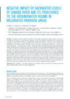
Negative Impact of Backwater Levels of Danube River and its Tributaries to the Groundwater Regime in Meliorated Riverside Areas
This paper describes updated calculation methodology of Danube backwater impact, occurred as a consequence of “Đerdap I” hydropower plant operation, onto the meliorated riverside areas. This methodology is based on hydrodynamic analysis of groundwater regime (size, duration, level and inflow changes) and quantification of melioration areas impairment which is caused by “Đerdap I” hydropower plant operation. By comparing the groundwater regime elements, obtained by variant hydrodynamic calculation in mathematical models for natural – not backed up and actual – ...HPP ''Djerdap 1'', backwater influence, groundwater regime, hydrodynamic analysis, melioration area, drainage system, additional energy engagementPredrag Pajić, Uroš Urošević, Dušan Polomčić, Milan Dimkić. "Negative Impact of Backwater Levels of Danube River and its Tributaries to the Groundwater Regime in Meliorated Riverside Areas" in IWA Specialist Groundwater Conference, Conference Proceedings and Book of Abstracts, 09-11 June 2016, Belgrade, Serbia, Institut Jaroslav Černi (2016) М33
-
To what extent reactivated faults are (not) responsible for karst process: example from Serbian Carpatho-Balkanides?
Ana Mladenović, Jelena Ćalić (2023)Carpatho-Balkanides represent part of the complex Dinaric – Carpatho – Balkan orogenic system, that geomorphologically dominates the central part of the Balkan Peninsula. The existence of this orogenic system is a result of closure of the Neotethys ocean and subsequent convergence of the Adriatic microplate and the Eurasian continent, that has been still active in the recent times. Such geodynamic characteristics conditioned complex tectonic structures, multiply reactivated during Late Cretaceous and Cenozoic times. The main aim of this work ...Ana Mladenović, Jelena Ćalić. "To what extent reactivated faults are (not) responsible for karst process: example from Serbian Carpatho-Balkanides?" in Abstracts and Guide Book 30th International Karstological School "Classical Karst" Karst - Approaches and Conceptual Models, Ljubljana : Scientific Research Centre of the Slovenian Academy of Sciences and Arts (ZRC SAZU), Karst Research Institute (2023) М64
-
Vulnerability methods in hard rock formation as a basis for groundwater risk assessment – from resource to source
Groundwater in a hard rock formation is most endangered at places where a potential source can discharge contaminants that can reach the saturated zone of an aquifer. In these circumstances, an essential tool for groundwater protection is the contamination risk map. This map is based on the integration of two maps: a hazards map, i.e., map of potential sources of contamination and a vulnerability map. The selection of a proper vulnerability method is an important task since the resulting ...karta rizika od kontaminacije, ranjivosti podzemnih voda, DRASTIC, EPIK, PI, COP, Nacionalni park TaraVladimir Živanović, Igor Jemcov, Veselin Dragišić. "Vulnerability methods in hard rock formation as a basis for groundwater risk assessment – from resource to source" in Geologia Croatica, Croatian Geological Survey (2022). https://doi.org/10.4154/gc.2022.23 М23
-
Damage quantification of built stone on Dark Gate (Belgrade, Serbia): sample of damage index application for decay rate evaluation
The Dark Gate is the monument of culture, part of the cultural and historical complex of the Belgrade Fortress. It is constructed of limestone blocks that after 270 years of exposure to environmental conditions and different anthropogenic influences show wide ranges of decay forms. During 2007, detail registration of all built limestone microfacies and weathering forms was done using tools of monument mapping. A correlation scheme ‘‘intensity– damage category’’ was made according to the type, intensity, and distribution of ...Maja Franković, Nevenka Novaković, Vesna Matović. "Damage quantification of built stone on Dark Gate (Belgrade, Serbia): sample of damage index application for decay rate evaluation" in Environmental Earth Sciences, Springer Science and Business Media LLC (2015). https://doi.org/10.1007/s12665-014-3843-z М22
-
Poreklo asocijacije Ni, Ag i Sn minerala u polimetaličnom ležištu Rudnik
Rudnomikroskopska, SEM-EDS i LA-ICP-MS ispitivanja rudne mineralizacije iz Pb-Zn-Cu-(Ag) ležišta Rudnik, ukazala su na lokalno prisustvo specifične asocijacije minerala nikla, srebra i kalaja, deponovane u tektonskoj breči, arsenopiritsko-pirotinskim, piritsko-pirotinsko-arsenopiritskim i kvarcno-sulfidnim žicama u harcburgitima. U tektonskoj breči deponovan je polimineralni sulfidni agregat kojeg čine pirotin (50), galenit, sfalerit i halkopirit. Arsenopiritsko-pirotinske žice odlikuje dezintegrisani agregat arsenopirita cementovan sa pirotinom. U piritsko-pirotinsko-arsenopiritskim žicama masivni pirit (50%) prorasta sa arsenopiritom i cementovan je polimineralnim agregatom pirotina, galenita i sfalerita. Minerali nikla, srebra ...Stefan Petrović, Aleksandar Pačevski, Viktor Bertrandson Erlandson, Rade Jelenković. "Poreklo asocijacije Ni, Ag i Sn minerala u polimetaličnom ležištu Rudnik" in 18. Kongres geologa Srbije "Geologija rešava probleme", Divčibare, 01-04 jun 2022., Srpsko geološko društvo (2022) М64
-
Истраживањe могућности коришћења нискотемпературних извора топлоте за одрживи развој енергетике градова
Miodrag M. Grujić (2014-06-04)Одрживост је континуиран процес балансирања између животне средине, економске исоцијалне димензије, који се односи на системска побољшања животног окружења.Енергија се налази међу покретачима одрживог развоја везано за потребу за повећањесоцијалног благостања, његову кључну улогу у економском развоју и утицај на животнусредину. Урбане зоне, као центри потреба за енергијом и емисија угљеника, пружајузначајне могућности за промоцију одрживости енергетског система заједнице.Планирање нових енергетских капацитета, у складу са принципима одрживог развоја,обухвата спровођење политике повећања енергетске ефикасности и увођења обновљивихизвора енергије. Дисертација ставља ...одрживи развој, даљинско грејање, модел, сценарио, вишекритеријумскаанализа, нискотемпературни извори, ELECTRE, БеоградMiodrag M. Grujić. "Истраживањe могућности коришћења нискотемпературних извора топлоте за одрживи развој енергетике градова" in Универзитет у Београду, Универзитет у Београду, Рударско-геолошки факултет (2014-06-04)
-
Stratigraphic implications of the Mio-Pliocene geodynamics in the area of Mt. Avala: new evidence from Torlak Hill and Beli Potok (Belgrade, Serbia)
Mt. Avala is located on the southern margin of the Pannonian basin (SPB), a border zone between the uplifted morphostructures of the Dinarides and Carpathian-Balkanides. Similar to the Pannonian basin, tectonostratigraphic evolution of the Mt. Avala area during the last 23 Ma has is characterized by syn- and post-rifting processes as well as tectonic inversion. Here, we present the results of field investigations of the Miocene‒Pliocene dynamics that led to different spatial positions of the same stratigraphic units (e.g. ...Ljupko Rundić, Meri Ganić, Slobodan Knežević, Dejan Radivojević, Miloš Radonjić. "Stratigraphic implications of the Mio-Pliocene geodynamics in the area of Mt. Avala: new evidence from Torlak Hill and Beli Potok (Belgrade, Serbia)" in Geologia Croatica (2019). https://doi.org/10.4154/gc.2019.11 М22
-
Režim pogranične reke Jerme
Vesna Ristić Vakanjac, Marina Čokorilo Ilić, Dušan Polomčić, Dragoljub Bajić, Boris Vakanjac, Peđa Kostić (2019)Reka Jerma izvire na Vlasinskoj visoravni u zoni Vlasinskog jezera, teče prema severozapadu padinama planine Gramade kroz selo Klisuru. Kod sela Strazimirovci prelazi u susednu državu Bugarsku, prolazi kroz Trnovsko ždrelo i zatim se ponovo vraća u Srbiju nedaleko od sela Petačinci. Uliva se kod sela Gradište u Nišavu. Ukupna dužina ove reke je 72.1 km od toga je 45.1 km formirala na teritoriji Srbije a preostali deo pripada Bugarskoj. Posmatrajući površine sliva nešto manje od 50 % pripada ...Vesna Ristić Vakanjac, Marina Čokorilo Ilić, Dušan Polomčić, Dragoljub Bajić, Boris Vakanjac, Peđa Kostić. "Režim pogranične reke Jerme" in Zbornik radova II Međunarodne naučne konferencije, Regionalni razvoj i prekogranična saradnja, Pirot, 2018., UO Privredna komora Pirot (2019) М33
-
Vodosnabdevanje i održivo upravljanje podzemnim vodnim resursima u Srbiji
Dušan Polomčić, Zoran Stevanović, Dragoljub Bajić, Bojan Hajdin, Vesna Ristić-Vakanjac, Petar Dokmanović, Saša Milanović (2012)Slično većini evropskih zemalja, udeo podzemnih voda u javnom vodosnabdevanju u Srbiji je oko 75%. Najveće rezerve su akumulirane u vodonosnim naslagama intergranularne poroznosti neogene i kvartarne starosti, kao i u karstnim izdanima. One su jedini izvor vodosnabdevanja pijacom vodom za Vojvodinu i veći deo Srbije. Delovi sa malim rezervama podzemnih voda su Šumadija i južni delovi zemlje, gde se koriste u većoj meri površinske vode. Do sada izvedena hidrogeološka istraživanja pokazuju da se zahvata oko 30% obnovljivih rezervi ...Dušan Polomčić, Zoran Stevanović, Dragoljub Bajić, Bojan Hajdin, Vesna Ristić-Vakanjac, Petar Dokmanović, Saša Milanović. "Vodosnabdevanje i održivo upravljanje podzemnim vodnim resursima u Srbiji" in Vodoprivreda, Beograd : Jugoslovensko društvo za odvodnjavanje i navodnjavanje (2012) M52
-
Osnovi hidrogeologije
Petar Dokmanović (2021)Petar Dokmanović. Osnovi hidrogeologije, Beograd : Univerzitet u Beogradu, Rudarsko-geološki fakultet, 2021 Без категорије
-

Connections between the Levant and the Balkans in the late Middle Pleistocene: Archaeological findings from Velika and Mala Balanica Caves (Serbia)
Dušan Mihailović, Steven L. Kuhn, Katarina Bogićević, Vesna Dimitrijević, Ana B. Marín-Arroyo, Jelena Marković, Norbert Mercier, Bojana Mihailović, Mike W. Morley, Predrag Radović, William J. Rink, Senka Plavšić, Mirjana Roksandić (2022)Major changes in the technological, economic, and social behavior of Middle Pleistocene hominins occurred at the onset of the Middle Paleolithic, 400e200 ka. However, until recently it was not possible to establish when, where, and how certain forms of Middle Paleolithic behavior appeared and spread into Southeastern Europe, mainly owing to gaps in the Paleolithic record. Here we report new results of dating, material culture, and the archaeological context of finds from the Balanica Cave Complex in Sicevo (Serbia). ...Dušan Mihailović, Steven L. Kuhn, Katarina Bogićević, Vesna Dimitrijević, Ana B. Marín-Arroyo, Jelena Marković, Norbert Mercier, Bojana Mihailović, Mike W. Morley, Predrag Radović, William J. Rink, Senka Plavšić, Mirjana Roksandić . "Connections between the Levant and the Balkans in the late Middle Pleistocene: Archaeological findings from Velika and Mala Balanica Caves (Serbia)" in Journal of Human Evolution (2022) М21а
-
Uticaj zemljišta i epikarsta na proces formiranja kvaliteta karstnih podzemnih voda istočnog dela Suve planine
Različite supstance, kako pravi tako i koloidni rastvori, migriraju i cirkulišu kroz zemljište, gde se dešavaju brojne hemijske reakcije. Kao rezultat ovog kretanja i biološke aktivnosti organizama, formiraju se slojevi sa specifičnim fizičko-hemijskim i biološkim svojstvima. Ovaj proces predstavlja prvi korak u promeni sastava površinske vode koja se infiltrira i postepeno prelazi u podzemne vode. Rastvaranje krečnjaka je već prilično intenzivno u površinskim zonama krečnjačka - epikarsta, o čemu svedoče podaci prikupljeni sa lokaliteta pećine Peč na Suvoj planini. ...Branislav Petrović, Živojin Smiljković, Veljko Marinović. "Uticaj zemljišta i epikarsta na proces formiranja kvaliteta karstnih podzemnih voda istočnog dela Suve planine" in Vodoprivreda, Srpsko društvo za odvodnjavanje i navodnjavanje, Akademija inženjerskih nauka Srbije (2024). https://doi.org/https://doi.org/10.46793/Vodoprivreda56.5-6.183P М51
-
Geneza i uslovi cirkulacije voda kompleksnih karstnih sistema Kučajsko-Beljaničkog masiva
Ljiljana M. Vasić (2017-07-14)postupaka koji je primenjen u cilju definisanja zona prihranjivanja i veze izmeđupodzemnih i površinskih voda, vremena koje voda provede u podzemlju, pri čemu seformira jedinstven hemijski sastav i temperaturni režim isteklih voda, bili su polaznaosnova za usmerenje na istraživanje karsta i definisanje teme doktorske disertacije.Kučajsko-beljanički masiv se nalazi u istočnoj Srbiji i pripada oblasti Karpatobalkanskogluka i idealan je poligon za istraživanje, obzirom da se u okviru njega nalazejaka karstna vrela i pojave toplih karstnih izvora na relativno malom rastojanju, ...karstni sistemi, geneza podzemnih voda, izotopske metode, starost voda,hidrogeohemijski procesi, dubina cirkulacije podzemnih voda, subtermalne i termalnevodeLjiljana M. Vasić. "Geneza i uslovi cirkulacije voda kompleksnih karstnih sistema Kučajsko-Beljaničkog masiva" in Универзитет у Београду, Универзитет у Београду, Рударско-геолошки факултет (2017-07-14)
-
Hidrogeohemijska valorizacija esencijalnih mikroelemenata mineralnih voda Srbije
Jana S. Stojković (2013-09-25)Mineralne vode još od davnina privlače pažnju ljudi i to kako u pogledu istraživanja iproučavanja, tako i u pogledu njihovog iskorišćavanja. Naročito je važno poznavanjesadržaja mikroelemenata u njima, jer su to komponente njihovog hemijskog sastavakoje ih odvajaju od tzv. „običnih“ malomineralizovanih voda.U ovom radu proučavani su odabrani esencijalni mikroelementi (fluor, bor, litijum,kalijum, stroncijum i silicijum), u mineralnim vodama Srbije, pri čemu je analiziranopreko 130 uzoraka mineralnih voda iz različitih geoloških sredina, to jest hidrogeološkihrejona. Cilj ovog istraživanja bio je ...esencijalni mikroelementi, faktori migracije, zakonomernosti rasprostranjenja, hidrogeohemijski procesi, multivarijantna statistička analiza, mineralne vode SrbijeJana S. Stojković. "Hidrogeohemijska valorizacija esencijalnih mikroelemenata mineralnih voda Srbije" in Универзитет у Београду, Универзитет у Београду, Рударско-геолошки факултет (2013-09-25)